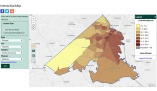
The interactive map uses data from the CDC’s Behavioral Risk Factor Surveillance System of 27 chronic disease measures configured by census tract for the nation’s largest cities.

The interactive map uses data from the CDC’s Behavioral Risk Factor Surveillance System of 27 chronic disease measures configured by census tract for the nation’s largest cities.